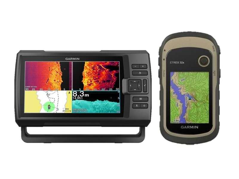
Become a Marine GPS Master With Our Easy Guide to GPS & Chartplotters
Date Posted: 26 April 2023
Before you set sail, make sure you have a marine GPS onboard. Why? Because a GPS, along with a fish finder and chartplotter, can make your next voyage all the better, whether you’re heading out to sea or just for a cruise around your local lake.
How Does a Marine GPS Work?
Whether you choose a Garmin handheld GPS with all the bells and whistles, or a budget-friendly option from another top brand, your marine GPS will work using the same principles regardless. As you may already know, GPS is a locating system that uses satellites to help you determine your location anywhere in the world, as long as the signal can get through to your GPS receiver.
Your GPS will then use at least 3 network satellites to triangulate your position. In Australia, these satellites are assisted by the DGPS broadcasting system, with stations placed all along the coastline. This ensures a higher rate of accuracy when confirming your position. This positioning happens incredibly quickly and you’ll see the results of this hard work displayed on your GPS. This may be as a set of coordinates or a marker on a digital map or chartplotter. While technological advancements have made modern marine GPS technology very accurate, it’s important to still pay attention to your surroundings.
Where you can, look for visual landmarks to confirm your position. Similarly, while chartplotters and GPS map displays are great for planning your route, and avoiding obstacles and hazards, like reefs and shallows, don’t forget to use common sense and your own skills. Maps can become outdated or have inconsistencies, so always keep an eye on where you’re going.
How to Use Your Marine GPS?
For the most part, your GPS unit will be continually calculating your position. This may be displayed as a changing number or position on the chartplotter. You just need to ensure that it is switched on, securely mounted and has plenty of battery life for your trip. If you want to make use of additional features like a chartplotter, the steps will vary depending on the unit you choose. However, generally, for a chartplotter, you will need to enter a desired waypoint.
This then allows the device to plan out your trip from your current location to where you want to go. You may be able to set multiple waypoints or even save them so you can visit multiple spots in one trip and remember favourite locations for another day.
How to Choose Your Ideal Marine GPS?
Are GPSs Necessary for Recreational Boating?
Firstly, before you jump into purchasing a marine GPS, it’s a good idea to determine if you need one. For instance, if you are boating in enclosed waters in New South Wales, a GPS is not required by law. Similarly, in regards to navigational equipment on open waters in New South Wales, your minimal requirements for navigational equipment are a map and compass. So, you don’t legally need a GPS with you. However, just because it isn’t a legal requirement, doesn’t mean you aren’t going to want to have one.
In an emergency situation, being able to relay your coordinates accurately can be vital in getting help fast, for instance. Similarly, depending on your GPS’ functions, it can help you keep track of favourite spots — even years between visits. It may also double as additional marine technology, like a fish finder, helping make your voyage more successful (and exciting!).
Can I Use My Phone GPS?
Another question worth asking before purchasing a marine GPS unit is if your smartphone already has the features you need. Technically, yes. In fact, there are a number of marine GPS apps available to add this additional functionality to your phone. However, there’s a fair few drawbacks to trusting your marine GPS duties to your phone.
For instance, if you’ve ever done a long road trip and relied on your phone for regular directions, you’ll know that GPS apps can chew up your battery and data. As a result, your phone may not last your full trip, leaving you without bearings. Similarly, as one of the best things about getting out on the water is escaping the hustle and bustle of everyday life, you can never guarantee you’ll have constant reception to ensure your GPS is working accurately.
Additionally, smartphones aren’t really built for life on the water. They can easily become damaged if splashed (or dropped into the water) or dropped onto the deck. Even when mounted, they can be subjected to a lot of vibrations or slip out, ending in disaster.
What Features Matter Most to You?
From a Garmin GPS complete with chartplotter to a Lowrance fish finder with GPS capabilities, there’s lots to choose from in this corner of the marine market. Ultimately, your perfect GPS is going to be one that meets your needs. This includes basics like its dimensions. You might prefer something smaller for portability or, alternatively, want something larger that can be securely mounted and easily read at a distance. Similarly, the display should be clear and easy for you to understand.
If there’s too much irrelevant or confusing information, you might find yourself tempted to use something else to track your position. Durability is also an important feature to keep in mind. As noted above, your average smartphone just isn’t tough enough when it comes to being on the water. While marine GPS are made to be water-resistant, you might also want to look at its drop-resistance or screen protection depending on how fast you usually travel or how rough the water can be. With these features nailed down, you can start to look at some more fun considerations.
For instance, why not get a GPS or chartplotter that is packed full of features with a fish finder thrown in there too? If you’re a keen fisher, this will help boost your catch and learn about all the best spots to drop a line. For a modern GPS setup, check out wireless connectivity features. You may be able to link up your GPS unit, via Bluetooth or WiFi, to your phone or other devices on your boat. This can make it easier to check your GPS while lazing in the sun or keeping an eye on everything from one central station, even directing the autopilot of your boat.
If you’re worried about drifting, some GPS units even have anchor alarms to tell you if you’ve started to move, even with the anchor dropped. To do this, they set up a digital ‘geofence’ perimeter around your boat and constantly check your position. If your position moves beyond the perimeter, the unit will sound an alarm to let you know your anchor is dragging and your boat is moving. If you’ve ever gone to sleep moored in one place and woken up somewhere else, you’ll know that having this feature can be a real relief.
Pinpoint Your Position With Up-to-Date Accuracy
If a marine GPS is now on your shopping list, be sure to check out the range at Mr Boats. We have lots of quality and affordable options to choose from, along with helpful accessories to ensure you get the most out of your new GPS unit. Plus, if you have any questions, our team is ready to help.


